Denne side viser den seneste status på projektet. Udviklingen af et VE-projekt er en dynamisk proces, hvor der løbende kan forekomme ændringer, bl.a. på baggrund af den lokale og kommunale dialog. Derfor kan projektspecifikke informationer ændre sig i løbet af udviklings- og planprocessen.
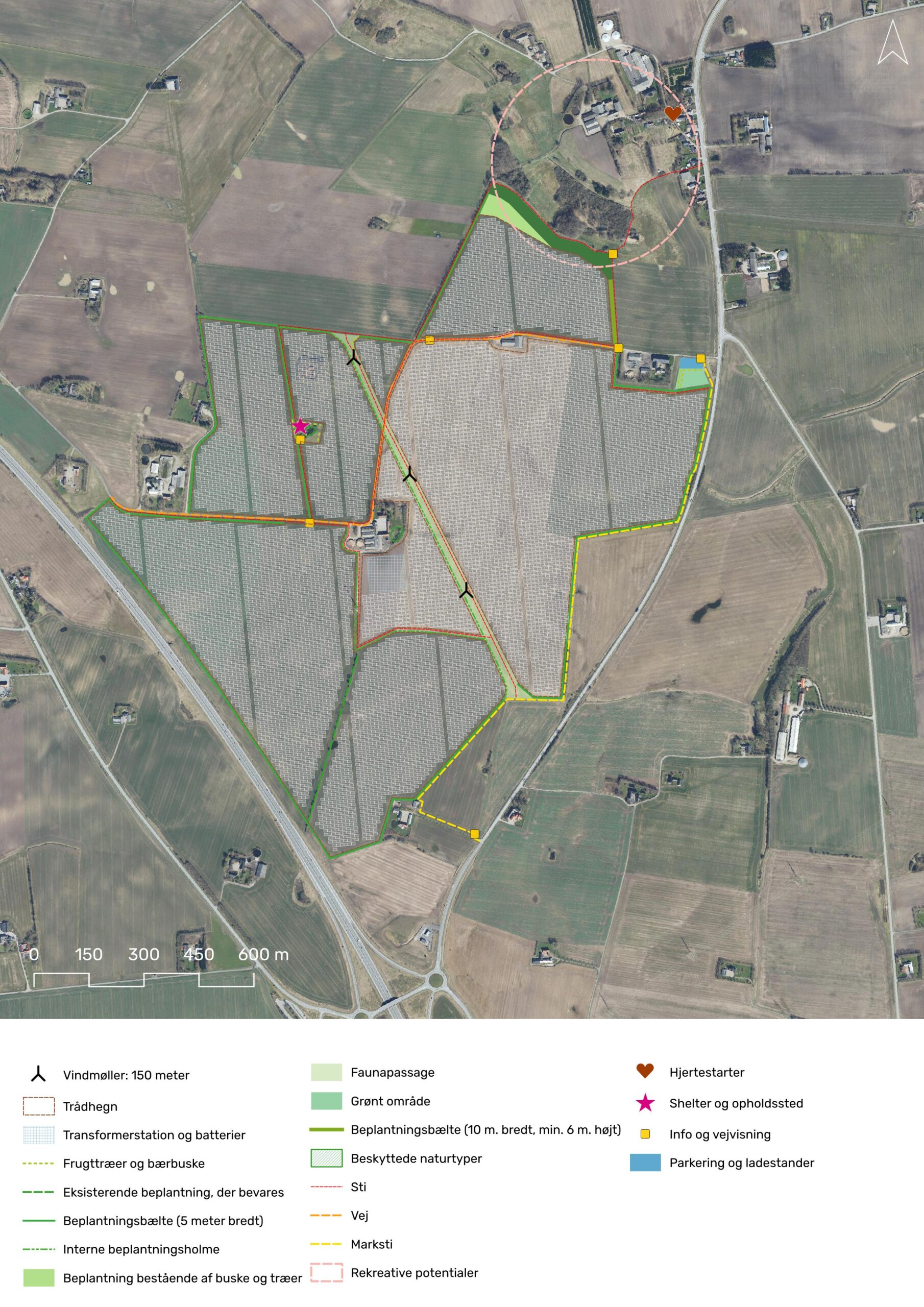
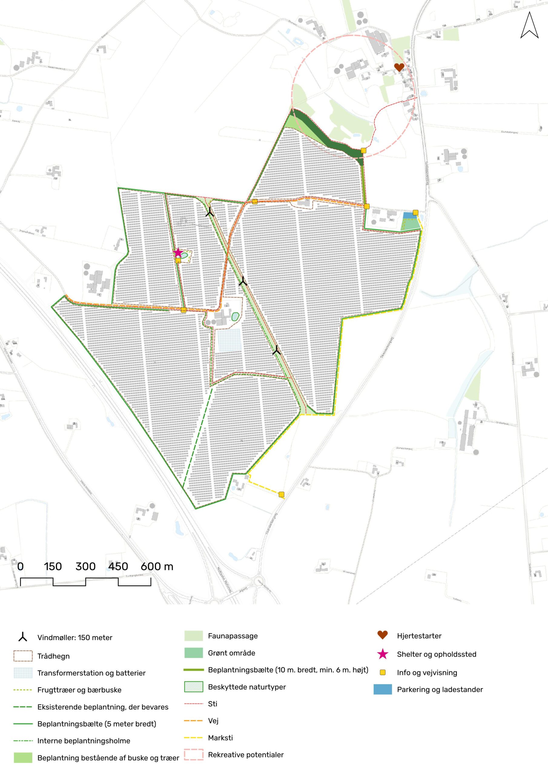
Projektets samlede bruttoareal udgør ca. 157 ha. Heraf udgør arealet til solceller ca. 137 ha. Projektområdet ligger i åbent land syd for lokalsamfundet Vester Ørum og nord for Lindved, ved den Midtjyske Motorvej.
Projektet omfatter et jordbaseret solcelleanlæg, vindmøller og BESS. Solcellemodulerne forventes at producere ca. 178,5 mio. kWh/år. Vindmøllerne forventes at have en produktion på ca. 38,5 mio. kWh/år. Energiparkens samlede produktion forventes dermed at være ca. 217 mio. kWh/år.
Ved afgrænsning af området er der lagt vægt på at anlægget udgør en samlet enhed, og at der er sikret afstand til naboer, som ligger i umiddelbar nærhed af projektområdet.
Større sammenhæng og tilgængelighed
Dette er projektets foreløbige dispositionsplan. Dispositionsplanen viser de forskellige elementer indenfor projektarealet. Dispositionsplanen er udarbejdet på baggrund af lokale input, kommunal dialog samt hensyn til den interne og omkringliggende natur og miljø.
Bruttoareal
ca. 157 ha
produktion
ca. 217.000 MWh
solcelleAREAL
ca. 137 ha
Sti
ca. 6,5 KM
friholdt areal
ca. 18 ha
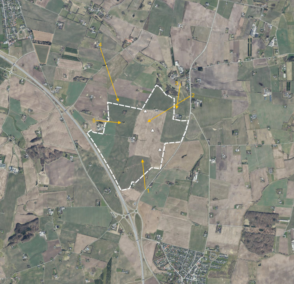
Visualiseringer
Der er udarbejdet en række foreløbige visualiseringer af projektet fra fem fotopunkter i området.
Fotoene er taget med en brændvidde på 35 mm, og fotopunkterne ses på kortet her.
Anlægget er visualiseret med 3,5 meter høje sydvendte paneler og omkransende beplantning på 4 meter.
OBS: Visualiseringerne er foretaget på et tidligt tidspunkt i projektudviklingen. Sidenhen er vindmøllerne blevet omplaceret mod vest. Nedenstående visualiseringer giver dog fortsat et retvisende billede af landskabet når projektet er etableret. Visualiseringerne opdateres i planprocessen.
Eventuelle indre beplantningsbælter og passager gennem anlægget er ikke visualiseret.