Velkommen til infosiden for Energipark ved Ballum Hede
Denne side viser den seneste status på projektet. Udviklingen af et VE-projekt er en dynamisk proces, hvor der løbende kan forekomme ændringer, bl.a. på baggrund af den lokale og kommunale dialog. Derfor kan projektspecifikke informationer ændre sig i løbet af udviklings- og planprocessen.
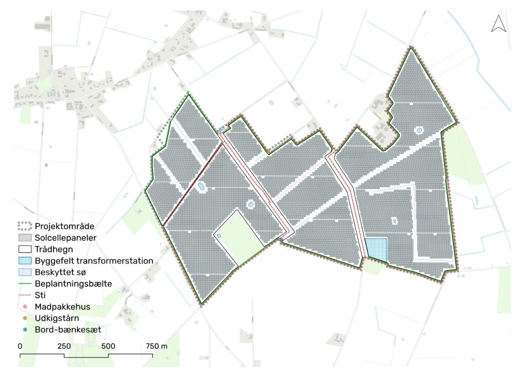
Projektets bruttoareal udgør ca. 140 ha. Heraf udgør arealet til solceller ca. 125 ha. Projektområdet ligger i åbent land sydøst for Husum-Ballum i Tønder Kommune.
Projektet omfatter et jordbaseret solcelleanlæg samt et batterianlæg til lagring af den producerede energi (BESS). Det giver mulighed for opstilling af solcellemoduler svarende til en årlig strømproduktion på op til 150.000 MWh.
Ved afgrænsning af området er der lagt vægt på, at anlægget udgør en samlet enhed, og at der er sikret afstand til naboer, som ligger i umiddelbar nærhed af projektområdet.
Større sammenhæng og tilgængelighed
Dette er projektets foreløbige dispositionsplan. Dispositionsplanen viser de forskellige elementer inden for projektarealet. Dispositionsplanen er udarbejdet på baggrund af lokale input, kommunal dialog samt hensyn til den interne og omkringliggende natur og miljø.
Bruttoareal
ca. 140 ha
produktion
op til 150.000 MWh
solcelleAREAL
ca. 125 ha
læhegn
ca. 7 KM
Sti
ca. 7,5 KM
friholdt areal
ca. 15 ha
Visualiseringer
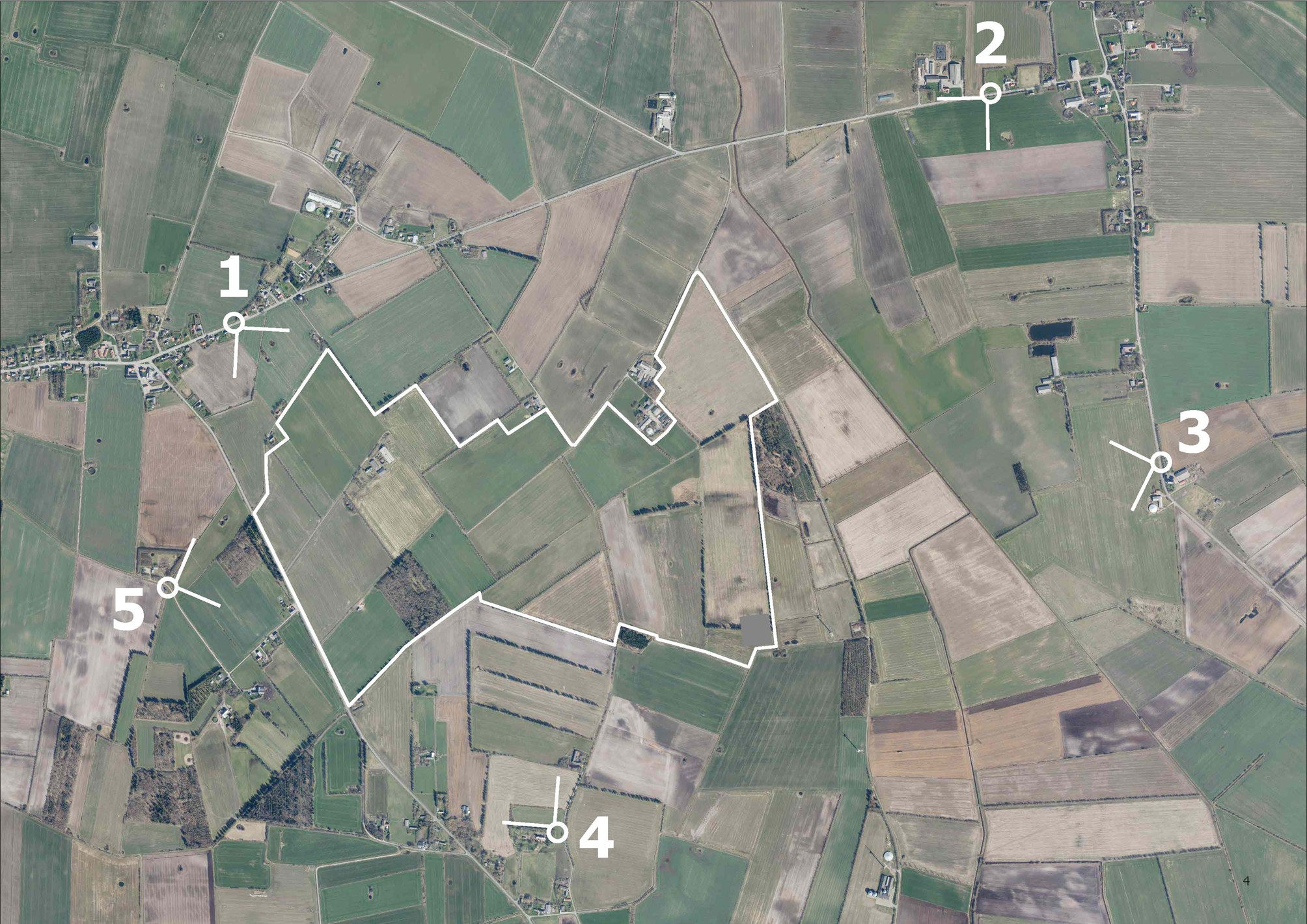
Der er udarbejdet en række foreløbige visualiseringer af projektet fra fem fotopunkter i området.
Fotoene er taget med en brændvidde på 35 mm, og fotopunkterne ses på kortet her.
Anlægget er visualiseret med 3,5 meter høje sydvendte paneler og omkransende beplantning med en højde på 3,5 meter.
Visualiseringspunkterne er udvalgt i samarbejde med Tønder Kommune for at illustrere projektets visuelle påvirkning fra udvalgte lokaliteter.
Fotopunkt 1
Fra Harknagvej med sydøst
Fotopunkt 2
Fra Randerup mod sydvest
Fotopunkt 3
Fra Randerup mod vest
Fotopunkt 4
Fra Skast Kirke mod nordøst
Anlægget vil ikke være synligt fra dette visualiseringspunkt. Placeringen af panelerne er derfor visualiseret med en transparant rød linje.